Unlocking the Beauty of Rajgad Fort Trek
- Sakura 🌸
- Jul 16, 2024
- 8 min read
“It is always the same with mountains. Once you have lived with them for any length of time, you belong to them. There is no escape.”
~Ruskin Bond
Rajgad, meaning ‘Killancha Raja’ or ‘The King of Forts’ is one of the popularly sought after trekking routes around Pune. It is one of the perfect trek routes for both beginner and advanced trekkers.
I have summited this magnificent fort three times. And every ascent was a different experience for me.

This blog includes anecdotes and experiences of all the three summits. The initial sections highlight my recent journey to the Fort, which took place on 8th June, 2024.
Before diving into the ‘what’ and ‘how’ part of the trek, let’s look at some of the facts.
Rajgad Fort: A History to Remember
Here are some interesting historical facts about Rajgad:
Rajgad was the first capital of the Maratha Empire during the reign of Chatrapati Shivaji Maharaj. Later, the capital was shifted to Raigad Fort.
Chatrapati Shivaji Maharaj ruled from Rajgad fort for around 26 years.
The height of Rajgad Fort is 4,515 ft or 1,376 m.
This gigantic fort is built on Murumb Devacha Dongar1.
Saibai, Shivaji’s first wife passed away on Rajgad Fort in 1659 CE due to a grave illness. Chatrapati Sambhaji Maharaj, her son, was just two and half years at that time.
Personal research reveals that it was difficult to siege Rajgad due to its huge diameter.
In the ‘Treaty of Purandar’, Rajgad was one of the forts that Chatrapati Shivaji Maharaj kept to himself, the rest were handed over to the Mughals. The Treaty was signed between Chatrapati Shivaji Maharaj and the Mughal General Jai Singh I, leader of the Mughal forces.
The Fort was under: Marathas<<Mughals<<East India Company<<Britishers<<GOI
Now, let’s get to the good part - the trek itself.
I would like to thank my buddy who tagged along with me.
A Week Before the Rajgad Fort Trek
It was the first week of June, and I was in the office, tackling Monday blues. The monsoon season has descended, an indication that the trekking season will begin soon.
I was more than ready to uphold the promise made to myself in the month of May - to restart trekking in June. A longstanding gap of eight to nine months shrunk my confidence, but a teeny tiny voice in my head told me to keep going.
As the week progressed, the hows and whats started rolling in my mind.
Which trek should I go for? How should I plan it? Solo or group?
My mind kept drifting from one trek route to the next. So, I said, “F**k it! Let’s not overthink and pick a route that I’m familiar with.” And Rajgad popped into my head.
I was skeptical about a solo trek, so asked a dear friend and he volunteered to tag along. He expressed his concerns about the route as he wasn’t a trekker, but I reassured him otherwise. Feeling motivated, he started researching a bit more about Rajgad trek.
We decided to do the trek on 8th June, 2024, take the Chor Darwaja Route, have dinner, and get back home by 8 or 9 pm on the same day.
Yes! Yes! I know what you guys are thinking. Why go for a day trek when Rajgad offers a beautiful camping place? Well, two things, firstly we didn’t have time or resources for a night stay. Secondly, the officials had debarred people from staying the night.
The Scooty Journey
There are multiple ways to reach the base village such as by bus, car, or a bike. We chose to drive all the way to ‘Gunjawane - the base village’ on my scooty.
We started our journey from Pune at 6:30 am.
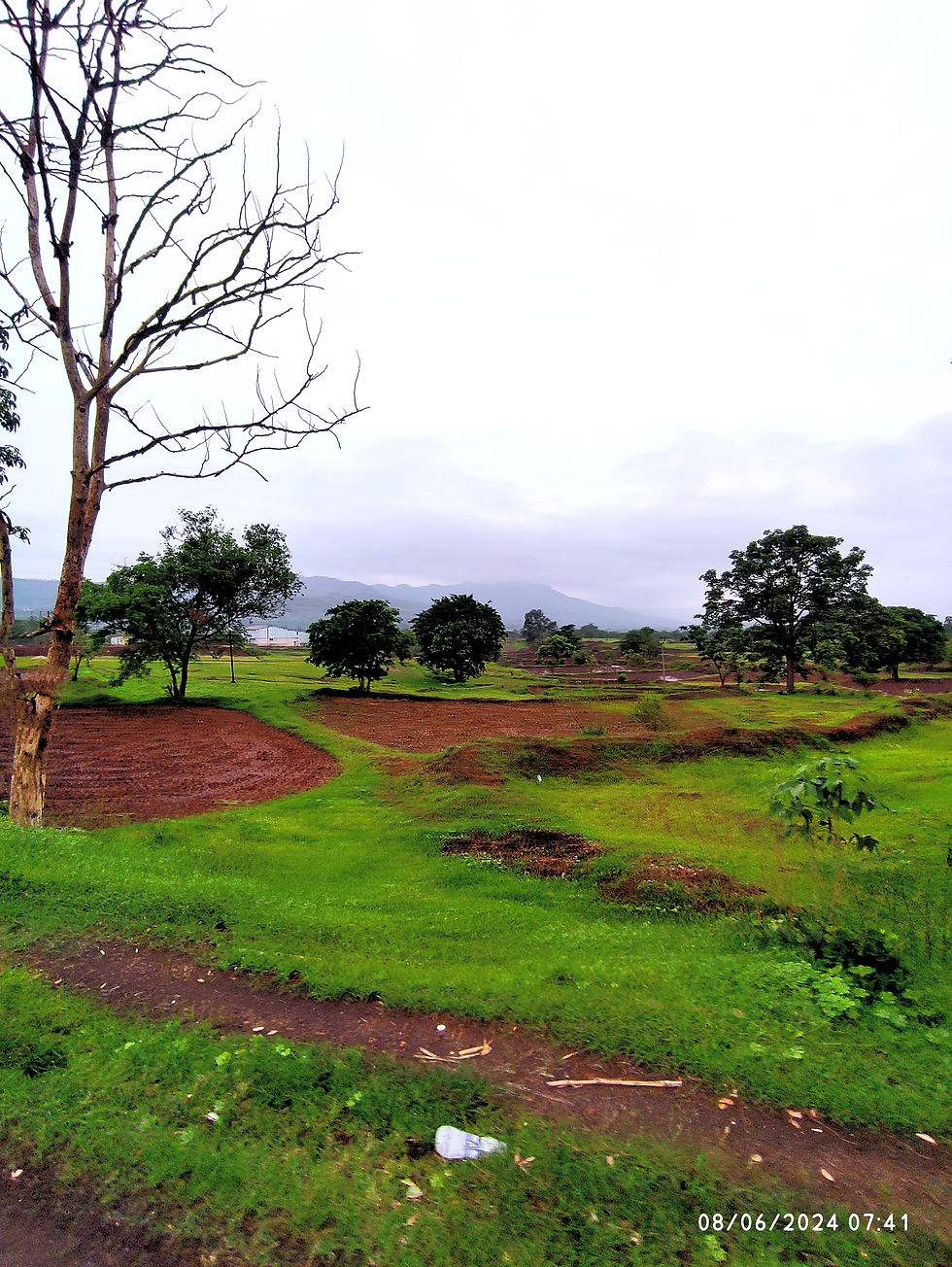
We rode our way through the Katraj Ghat, catching sunrise on-the-go. The ghat overlooked the magnificent valley of the Sahyadris. A lush, thick treeline covered the other side of the road. Picturesque landscapes at every twist and turn of the road continued to steal my heart away.
We said goodbye to the Ghats and hit the highway for some breakfast.
The next leg of the journey took us to ‘Khed Shivapur’, from where we took a right turn and entered the rural area.
As soon as we drifted away from the highway, we were greeted with a boulevard. Canopy of trees enclosed upon us as we drove further in the remote region.
We were surrounded by paddy fields on either side of the road. Fresh scent of wet soil wafted in the air as we drove past the fields. This scene is still stored in one of my memory boxes, with ‘Khwabon ke Parindey’ playing at the backdrop.
Our last leg of the journey encompassed driving through the narrow village roads, with fairly high speed breakers. I am surprised that my hips are still in place.
At 8 am we arrived at Gunjawane.
Lost in the Wilderness

Before I get to the next part, here are some quick facts:
There are multiple trek routes, but the popular ones are - Pali and Chor Darwaja routes.
The Pali route, named after the village ‘Pali’ is simple compared to Chor Darwaja Route.
There’s another trek route that runs from Torna to Rajgad, it is about 7-8 km long.
We took the Chor Darwaja Route, whose base village is Gunjawane. They have a systematic parking system, along with multiple small hotels.
After parking the vehicle, we set out for an hour and a half hike towards the fort. We had barely begun when suddenly I heard someone.
“Take that route,” said a grey-eyed trekker. This put me in a frenzy. At the back of my head I knew that was the wrong turn. However, dismissing the thought, I indicated my friend, and we followed the grey-eyed man. After walking 100 m it became clear to me that we were on the wrong route. We were lost in the wilderness.
Surprisingly, I was pretty calm, and excitedly took up the challenge of finding the right route. This wasn’t the first time I was lost on a trek. So, I knew what we had to do - just keep moving forward.
The bright side of losing the trail was that I ate lots of Karvanda or Kali Maina or Karonda fruits. Freshly plucked from the bushes.
We could see the Rajgad Fort from our spot. Tall grasses, bushes, and weeds covered our path. So, it took us a while to hunt down the correct route.
But, we got it in the end. We said goodbye to the grey-eyed man, and continued our way towards the mighty Rajgad Fort.
Traversing the Trailṣ
I have divided the Rajgad trek route into three major sections, so you won’t get lost like I did.
Section 1: Gunjawane Village to the End of the Rocky Road
It takes around 20 to 25 mins to complete this section. We missed out on this part, hence got lost. After leaving the last hotel and the parking area, there’s a gravel road that leads to a gate with a sign - ‘Rajgad Trek Route’, that’s the rocky road trail.
Section 2: Rocky Road to the Plateau
The trail curves into a slope at the end of the rocky road. There’s a slight steep ascent to the plateau. Since it was the monsoon season, the route was muddy and slippery. It’s best to wear rubber soled shoes for extra grip.

On the way, a lot of villagers sit with pots of lemonade, drinking water bottles, buttermilk, and eatables. The prices are reasonable, and Gpay doesn’t work due to lack of network. The decision to carry cash with us paid off.
On the way to the plateau, my friend threw a kleenex on the trail, which pissed me off. I strictly told him not to do it again and picked up the thrash. I think he was pretty shaken up after seeing my reaction. Nevertheless, I hate litter, and everyone must preserve and grow nature.
Section 3: Plateau to Chor Darwaja

This was the trickiest part of the trek. After leaving the plateau, we saw the railing going all the way to the Chor Darwaja. A steep slope of rocks separated us from our destination.
My dear friend was cursing me all the way to the top cause the last patch was hard for him. After using rock climbing tactics, we finally made it to the Rajgad Fort.
The Mighty Rajgad Fort
Here’s what to lookout for on the Rajgad Fort:
1. Temples


There are three temples on Rajgad Fort - Padmavati Devi Mandir, Rameshwar Mandir, and another Shiv Mandir on Balekilla.
2. The Pond

On Padmavati Machi, there’s a huge pond. It is not drinking water, so best to stay away from it. The two wells near the Padmavati Mandir contain drinking water.
3. The Samadhi

The samadhi on Padmavati Machi is of Maharani Saibai, the first wife of Chatrapati Shivaji Maharaj.
4. Balekilla

Balekilla is the main and the highest point of the Rajgad Fort. Here, official affairs were conducted during Maharaj’s reign. There’s a lake on top of Balekilla called Chandra Kor lake or Chandra lake.
Additionally, there’s Uttar Buruj, a Shiv Mandir, and Rajwada Avshesh.
The route to Balekilla is similar to the 3rd section of the Rajgad trek.
5. Suvela Machi


Suvela Machi is one of the best spots to capture sunrise. The Machi looks like a snake slithering through the hills. A view to cherish for a lifetime.
There’s also a Gupt Darwaja on Suvela Machi, along with Chilkhati Buruj. Don’t miss out on Nedhe or the Needle Hole and Hatti Prastar on the way to Suvela Machi.

6. Sanjivani Machi
A spot known for witnessing breathtaking sunsets. There’s also a Tehalni Buruj at Sanjivani Machi.
We never made it to the end of this Machi cause we were blocked by a herd of cattle and oxen. They were in attack mode, so we ran off.

Pali vs Chor Darwaja: Which is the Best Trek Route?
From a personal perspective, the Pali route is the easiest and the fastest. It is recommended for beginner trekkers. However, if you want to enjoy a long hike, scenic beauty, and you’re up for a challenge, then go for the Chor Darwaja route.
What Did I Pack for the Rajgad Trek?
Here’s what I packed for a day trek to the fort:
At Least 2 L water
Light snacks like fruits, protein bars, chocolate, etc.
Lightweight jacket
Poncho
ID Card and cash
First aid kit
Cap, gloves, sunglasses, and buff
Change of clothes
How Can You Plan a Trek to Rajgad?

1. Mode of Transport
You can either opt for a car, ST bus, or a bike. Just set the Google Map and go to the base village.
2. Getting to the Base Village
As discussed in the article, there are two main routes. The base villages of both the routes are Pali and Gunjawane. Pali being the easiest route of the lot.
3. Food and Water Sources
You’ll find ample hotels at the base village. So, don’t worry about food and water. However, don’t drink water from the pond on top of the fort. Only the well water is safe for drinking.
4. What Precautions Do You Need to Take?
Emergency contacts
First aid kits
Save the map offline on Google maps
Check petrol and tyres
Drink plenty of water a day before the trek.
Check the fitness levels of everyone in the group.
5. Can You Fly Solo?
Yes, definitely! I would recommend Rajgad trek for those who wish to try their hand at solo trekking. Go during the weekends, so there are people around. Also, take all the necessary precautions. Inform your loved ones, share location, and keep emergency numbers on speed dial.
When Not to Plan for Rajgad Trek?
I would suggest that you avoid going to Rajgad during the summer season. You’ll not only feel an unquenchable thirst, but also experience sun stroke. Plus, the view is not great at that time of the year.
How Much Did I Spend for a 1 Day Trek to Rajgad?
I wrapped up the whole trek for two in under 500! Here’s the breakdown:
Petrol: 200 Rs.
Lemonade: 40 to 80 Rs. (we had it 3-4 times)
Breakfast: 100
Parking: 20
Overhead: 50 Rs.
P.S. On the way home, we experienced tremendous rainfall. It was pouring like crazy for over an hour. We drove for a while, but ended up taking shelter in the village. It was the best rainfall that I had experienced after a very long time. Felt blessed and grateful to witness one of nature's beauty in action.
Liked what you read? Write your views on the blog in the comment section below.
By,
Chaitali A
Disclaimer: The author(s) and contributors of The It List not responsible for any damage, personal injuries or death as a result of the use of any information, maps, routes, advice, gear or techniques discussed on this blog and website. All outdoor activities are carried out at your own risk.
Footnotes:
Murumbadev mountain was converted into an impregnable fort and named as Rajgad Fort.
Chor Darwaja literally means ‘The Thief Door’ can also mean the ‘Back Door’
Machi: A section of the fort
Samadhi: Shrine
Buruj: Watch tower
Rajwada Avshaesh: Palace remains
Gupt Darwaja: Hidden door
Hatti Prastar: Elephant shaped boulder
Comments